Tappa 09: Da Sassalbo a Càsola in Lunigiana
Seconda tappa toscana che finalmente regala un’ampia e spettacolare vista, in particolare dai Prati di Massicciano, sulla sempre più vicina catena delle Apuane – dal M. Roccandagia fino al M. Borla – dominata dalla possente parete nord del Pizzo d’Uccello e dal M. Sagro, giungendo infine, dopo aver superato il borgo di Regnano e l’amena…
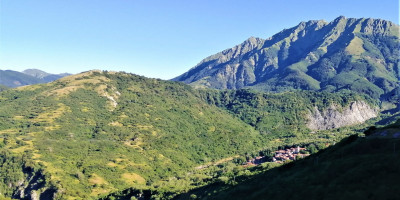
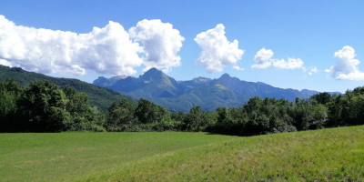
Seconda tappa toscana che finalmente regala un’ampia e spettacolare vista, in particolare dai Prati di Massicciano, sulla sempre più vicina catena delle Apuane – dal M. Roccandagia fino al M. Borla – dominata dalla possente parete nord del Pizzo d’Uccello e dal M. Sagro, giungendo infine, dopo aver superato il borgo di Regnano e l’amena Pieve di Offiano, al borgo di Càsola Lunigiana ed al suo suggestivo centro storico, ove a palazzo Ambrosi vi è la sede del piccolo ma interessante Museo del Territorio dell’alta valle Aulella.
Segnalazioni
- Tappa impegnativa per lunghezza e dislivelli, senza punti di ristoro intermedi né negozi (invece buona disponibilità di acqua).
- Qualche difficoltà di orientamento per segnaletica carente nelle radure a nord del Giogo di Vendaso.
Descrizione della Tappa
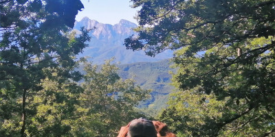
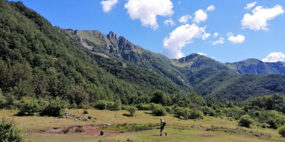
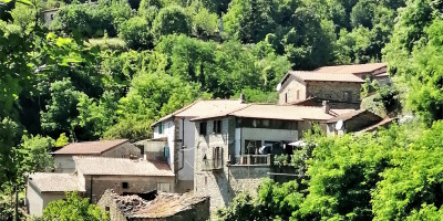
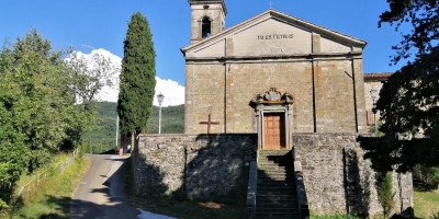
Lasciato il paese di Sassalbo si segue per 1 km circa la Strada Provinciale fino a raggiugere la Statale 63 (attenzione possibile traffico veloce) che si segue verso valle per un brevissimo tratto, superando due alti ponti (spettacolare vista sul paese di Sassalbo, sui suoi gessi e sui soprastanti Prati di Camporaghena) fino all’imbocco del sentiero, nei pressi di un gruppo di case abbandonate, sulla sinistra. Si sale dapprima per fitto bosco e poi attraverso due ampie radure (attenzione a mantenere la traccia) fino a lambire la cima del Giogo di Vendaso da cui si imbocca uno splendido sentiero nel bosco che con piacevole saliscendi si sposta verso Est, superando il bivio per il paese di Vendaso per poi scendere più decisamente verso la località Prati di Massicciano, ampia radura con splendida vista sulle Apuane e sulle pareti meridionali dell’Appennino Tosco Emiliano. Dai Prati di Massicciano (fonte) inizia una lunga e costante discesa, dapprima su mulattiera, poi carrareccia ed infine su strada bianca che lentamente conduce alla località Restì. Da Restì, lasciando sulla sinistra il sentiero LT (possibile variante EE per giungere al Passo Cadin), si prosegue invece per ancora un paio di km sulla strada bianca fino a poco prima dell’abitato di Mommio da dove, imboccando a sinistra una mulattiera, si scende a guadare il torrente Mommio per poi risalire sul versante opposto fino al Passo Cadin. Dal Passo inizia una nuova lunga discesa che dapprima conduce a Regnano (Castello e Villa; fonte). Da Regnano Villa un sentiero (che supera su uno stretto ponticello una profonda forra) conduce all’importante Pieve di Offiano (fonte) da cui per stretta strada asfaltata (a bassissima intensità di traffico) si giunge dapprima al borgo di Castiglioncello e poi di Vigneta. Un ultimo tratto di sentiero scavalca il colle che separa Vigneta dalle prime case del suggestivo borgo di Càsola in Lunigiana (farmacia, bar, negozi).
Vi preghiamo di segnalare eventuali criticità o proposte di miglioramento dell’itinerario scrivendo a cairesentierodeiducati@gmail.com . Grazie per il vostro aiuto!