Tappa 12: Da Fosdinovo a Sarzana
Dal borgo di Fosdinovo, straordinaria terrazza sulla bassa valle del fiume Magra con ampia vista sulle isole e la costa tirrenica, dal Golfo di La Spezia a Marina di Massa, si inizia una lunga ma rilassante discesa verso Sarzana in cui alle foreste di castagno prendono improvvisamente sopravvento estesi uliveti e vigneti tra cui la…
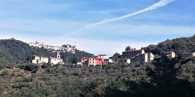
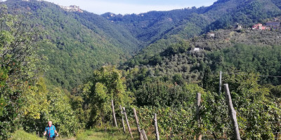
Dal borgo di Fosdinovo, straordinaria terrazza sulla bassa valle del fiume Magra con ampia vista sulle isole e la costa tirrenica, dal Golfo di La Spezia a Marina di Massa, si inizia una lunga ma rilassante discesa verso Sarzana in cui alle foreste di castagno prendono improvvisamente sopravvento estesi uliveti e vigneti tra cui la presenza umana (strade, abitazioni e aziende) si fa via via sempre più evidente. Le rovine dell’antica Luni romana e la deliziosa, vivace cittadina fortificata di Sarzana (o la sua stazione ferroviaria) rappresentano l’ultima degna meta del nostro lungo percorso dalla “grande pianura” al mare.
Segnalazioni
- Percorso lungo, ma prevalentemente in discesa. Nell’ultimo tratto (Via Francigena) su strade asfaltate.
- Prevedere temperature elevate nei periodi estivi, causa bassa quota. Frequenti possibilità di rifornimento d’acqua.
Descrizione della Tappa
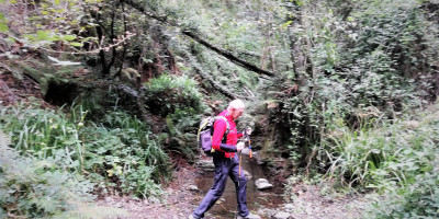
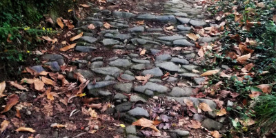
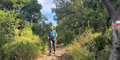
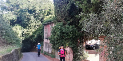
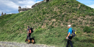
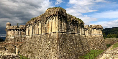
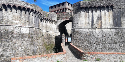
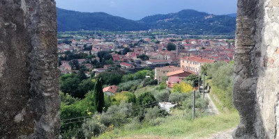
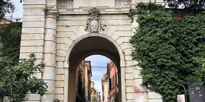
Attraversato l’antico borgo di Fosdinovo lungo il suo corso principale (Via Roma), non senza aver prima visitato il suo magnifico castello, si esce dalla sua porta meridionale con splendida e ampia vista sulla bassa valle del fiume Magra e sulla costa tirrenica e si raggiunge Via Prato che si percorre fino al parco giochi /campi da tennis (attenzione: breve tratto trafficato), in prossimità dei quali, sul tornante, si imbocca il sentiero che inizia a scendere in località Peschiera. Inizia così una lunga discesa su terreno dal fondo sconnesso, immerso in un ambiente inaspettatamente selvaggio fino a congiungersi con il sentiero CAI 294 verso il borgo di Gignago che si guadagna dopo una breve ma ripida salita. Da Gignago, attraversato il Fosso del Vescovo si giunge a Caprognano ove il percorso segue il sentiero CAI 303 che inizia a spingersi verso sud-ovest in un ambiente sempre più mediterraneo caratterizzato da estesi coltivi ad ulivo e vigneto e boschi di quercia per raggiungere Caniparola (da qui possibile deviazione per Luni , vedi scheda). Da Caniparola si imbocca in senso inverso la Via Francigena (tappa 25 Sarzana-Massa), tratto inizialmente su strada asfaltata, per poi immettersi sul percorso ciclo-pedonale del Canale Lunense e successivamente seguire il sentiero Luparello , che porta direttamente alla fortezza di Sarzanello, detta anche Fortezza di Castruccio. Qui il percorso merita una breve deviazione per salire alla fortezza ed effettuarne il giro dei fossati, dove si possono osservare le sue imponenti mura e le soluzioni architettoniche, e da dove si gode del meraviglioso panorama della vallata del Magra con lo sfondo del porticciolo di Bocca di Magra e del promontorio del Caprione e soprattutto della città di Sarzana, vista dall’alto, con i suoi torrioni e con i campanili che svettano. Tornati sul sentiero, si raggiunge in poco tempo il centro di Sarzana dove ci si immette nella via principale che, passando dalla casa torre dei Bonaparte, patrizi Sarzanesi da cui discese Napoleone Bonaparte, si arriva in piazza Matteotti, sede del palazzo del Comune, ove terminatermina il Sentiero dei Ducati.
Informazioni Utili
Volendo proseguire per la Via Francigena, che da qui supera Porta Parma e conduce, attraverso l’Appennino Emiliano a Berceto – Fornovo – Fidenza , si può tornare al luogo di inizio del Sentiero Dei Ducati senza ripercorrere i luoghi già visitati.
A Caniparola ristorante e a 500 metri direzione SS. Aurelia, ostello per pernottamento e cena (per info sig. Tommaso Paturzo 340 7180191)
Vi preghiamo di segnalare eventuali criticità o proposte di miglioramento dell’itinerario scrivendo a cairesentierodeiducati@gmail.com . Grazie per il vostro aiuto!