

Il Sentiero dei Ducati a Piedi
Il nuovo percorso escursionistico del Sentiero dei Ducati, ideato e coordinato dal Club Alpino Italiano di Reggio Emilia in collaborazione con le sezioni CAI di Fivizzano e Sarzana, segue in buona parte il tracciato originale del 1993, discostandosene però in alcune tratte per motivi legati alla sua effettiva attuale percorribilità oppure per migliorane la fruibilità. In particolare rispetto al percorso originale è stata aggiunta una nuova tappa, quella iniziale, che collega la città di Reggio (ben servita da mezzi pubblici) a Quattro Castella, attraversando il suggestivo paesaggio dell’alta pianura reggiana, tra vigneti e coltivi.
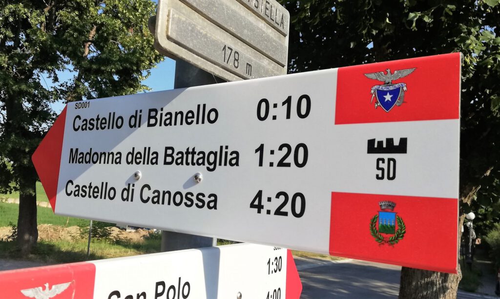
E’ segnalato dai volontari del CAI che in molti tratti hanno anche provveduto ad apporre apposita simbologia (corona turrita con sigla “SD” o semplice sigla “SD”) in aggiunta ai classici segnavia bianchi e rossi. Poiché in Lunigiana il Sentiero dei Ducati segue in buona parte le tappe dello storico Trekking della Lunigiana si potrà trovare, per lunghi tratti, anche la specifica simbologia si tale percorso (sigla “TL”). Sono inoltre state installate numerose paline con frecce segnaletiche indicanti le destinazioni intermedie e le durate indicative di cammino. Sono infine disponibili anche le tracce GPX per navigatori satellitari (vedi pagina “Download”).
Frecce Segnavia Nuove
Non potranno tuttavia mai mancare nello zaino le cartine topografiche disponibili sul mercato (vedi sezione “Cartografia” nella pagina “Informazioni” di questo sito) fondamentali compagne di viaggio, insieme a bussola ed altimetro, di ogni serio escursionista. Infatti, anche considerando la notevole lunghezza del percorso e le aree naturali attraversate, non mancano tratti che richiedono buone capacità di orientamento e di progressione in autonomia in ambiente montano, spesso in località amene e solitarie, lontano da strade e paesi, dove non sempre il segnale telefonico è disponibile, men che meno la possibilità di accedere a servizi dati.
Il Sentiero dei Ducati è un percorso escursionistico, non turistico ! Pertanto deve essere affrontato da escursionisti adeguatamente allenati ed equipaggiati mentre non è consigliabile per persone prive di adeguate competenze ed esperienze di progressione in autonomia in ambiente montano, che potranno invece percorrerlo con il supporto di guide professionali o sfruttando le tante iniziative che ogni anno il CAI promuove per i propri soci lungo tale percorso.
La Suddivisione in Tappe
Le 12 tappe del percorso trekking sonno suddivise in 7 tappe in territorio Emiliano (da Reggio Emilia a Rigoso, in Provincia di Parma) e 5 tappe in territorio Toscano e Ligure (da Rigoso a Sarzana, in provincia di La Spezia). Questa suddivisione è stata definita tenendo conto di un mix di fattori quali la lunghezza e dislivello di ogni tappa, la disponibilità di alloggi e punti di ristoro (piuttosto rari nella parte centrale del percorso) e la possibilità di avere tempo a disposizione per visitare i tanti luoghi di interesse lungo il percorso.
Vi sono tuttavia molte soluzioni sia per personalizzare il proprio trekking, variandone durata e numero di tappe, sia per accorciarlo una volta giunti in una delle varie località che consentono con mezzi pubblici di rientrare al luogo di partenza (vedi nella pagina “Informazioni” le sezioni dedicate ).
Ogni escursionista dovrà in ogni caso preventivamente pianificare il trekking sulla base del proprio stile di cammino, grado di allenamento e interessi personali. Per questo motivo questo sito è stato dotato di un potente strumento di cartografia digitale contenete anche tutte le informazioni e i dati utili per pianificare nel dettaglio la propria escursione, verificando sempre attentamente ed in anticipo la disponibilità di alloggi.
ATTENZIONE
I percorsi descritti in questo sito sono di difficoltà “Escursionistica” (E) con brevi tratti o varianti di difficoltà “EE” (Escursionisti Esperti), come più precisamente indicato in altre pagine di questo sito o in documenti da esso scaricabili. Tali difficoltà possono aumentare anche significativamente, con il variare delle condizioni meteo e dello stato del terreno (fango, neve, ghiaccio). Alcuni dei numerosi guadi potrebbero diventare difficili o pericolosi in caso di forti piogge o al disgelo.
Per tutti questi motivi un’escursione su questo percorso va preparata e affrontata con le dovute precauzioni e attenzioni, adottando tutti i più noti e comuni comportamenti di prudenza per l’escursionismo in montagna ed in ambiente naturale.